

Feral animal control and training services across the Northern Territory — specialising in aerial shooting, ground and thermal operations, drone surveillance, trapping, and humane management of feral and overabundant native species for government, land councils, rangers, and pastoral clients.
Feral Animal Control
humane, discreet solutions
Learn To Shoot delivers pragmatic, safety-first pest and feral animal control services and training tailored to Land Councils, Indigenous Ranger Groups, Pastoral Companies, Stations, Mines, Airports and Government. Our team blends operational experience with culturally aware, field-tested techniques that prioritise welfare, legal compliance and measurable outcomes.
NT Police Approved
Defence Cleared
Risk‑assessed, site‑specific plans and documented SOPs
Self‑sufficient mobilisation by either air or road and all onsite logistics
Learn to Shoot is licensed, certified and equipped to undertake the following tasks:
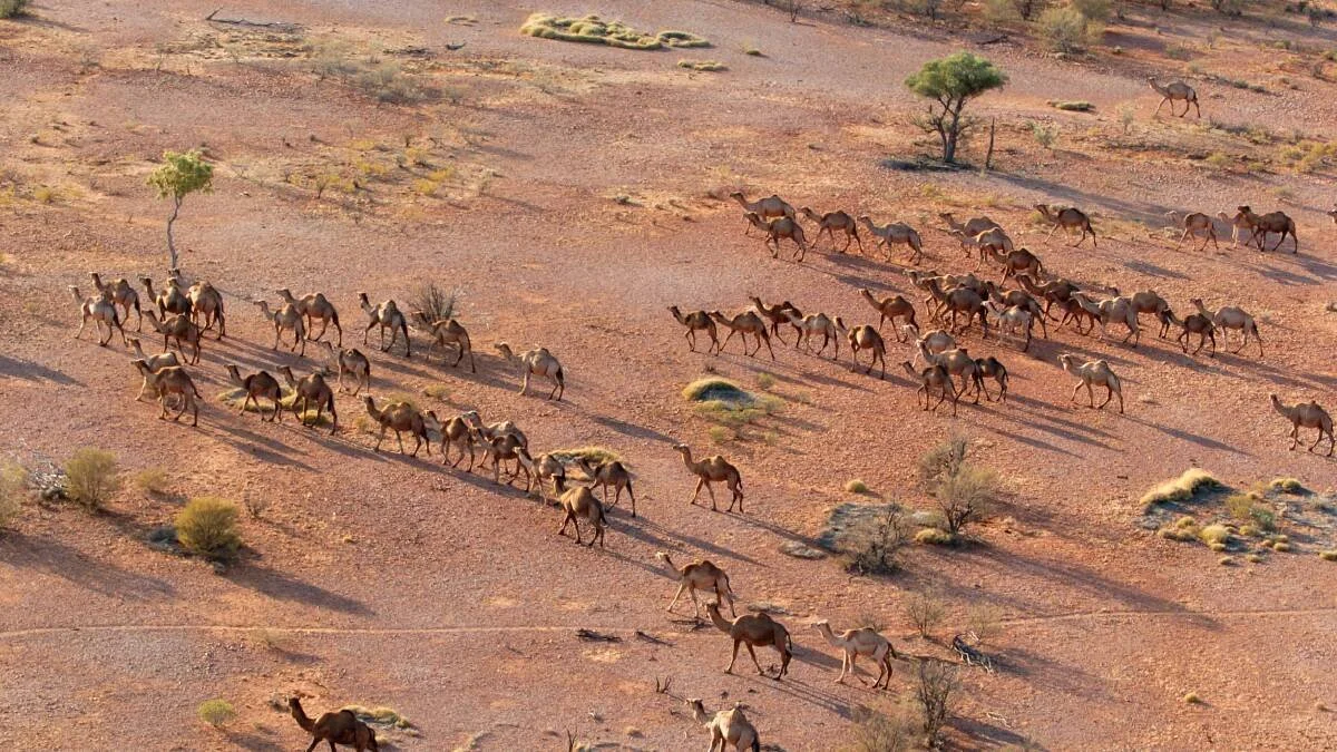
Aerial Shooting
What it is: Precision culling from aircraft to reduce populations over large, inaccessible areas.
Capability:
CASA Commerical Pilots Licence (A+H) with Low Level Approval
Compliant carraige and discharge procedures and operator approval
NT Police approval
Why it’s used: Rapid reduction of feral vertebrate populations, especially where ground access is impractical or slow.
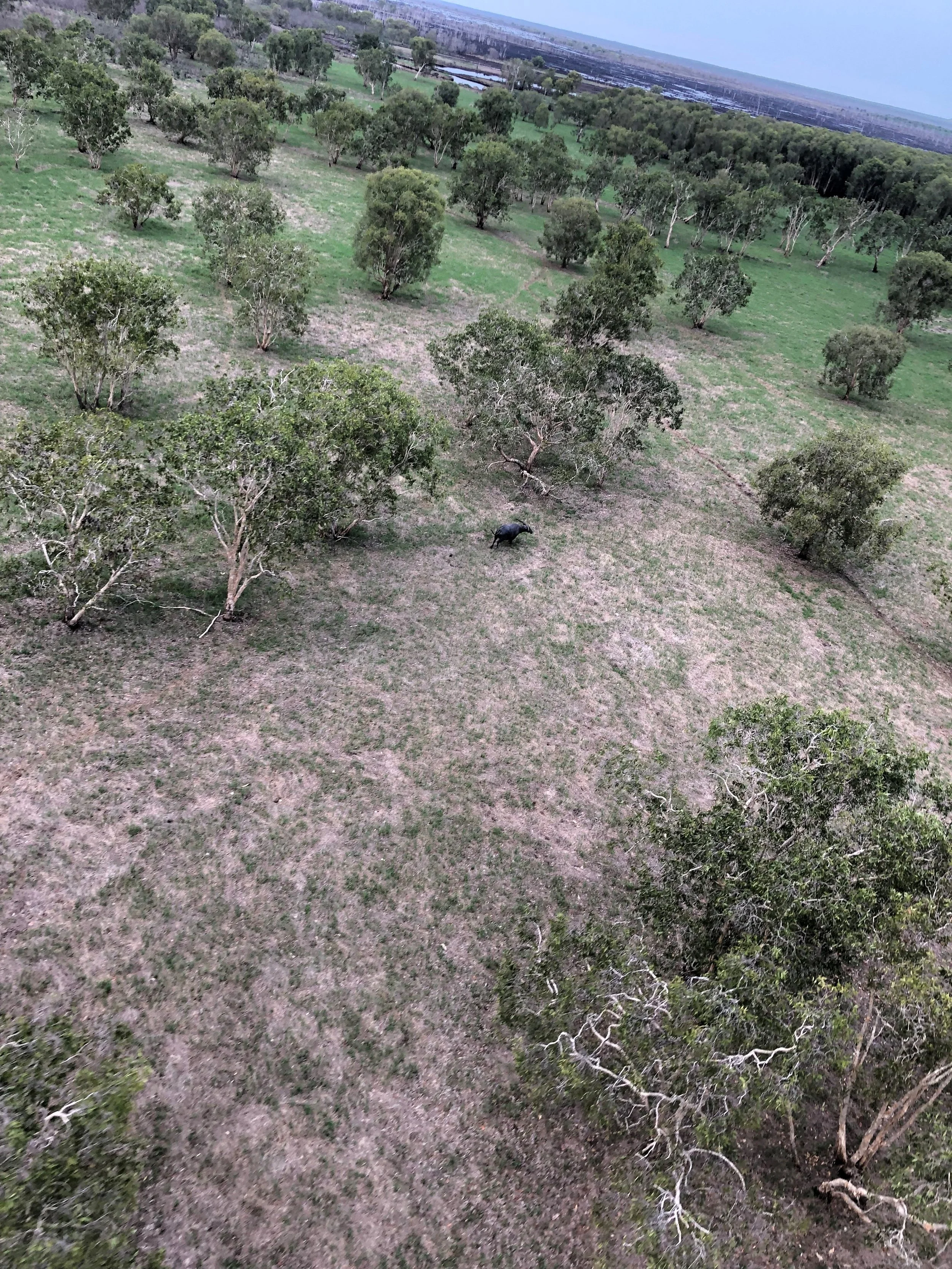
Ground Shooting
What it is: Controlled, targeted shooting from ground teams using various approaches dependant on the outcome required.
Why it’s used: Flexible, low‑impact method suitable for targeted removal near sensitive infrastructure, homesteads and stock areas.
Applications: Stations, ranger programs, peri‑urban mitigation, airport runway strike‑risk management.
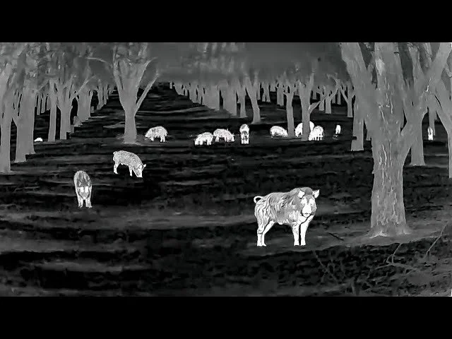
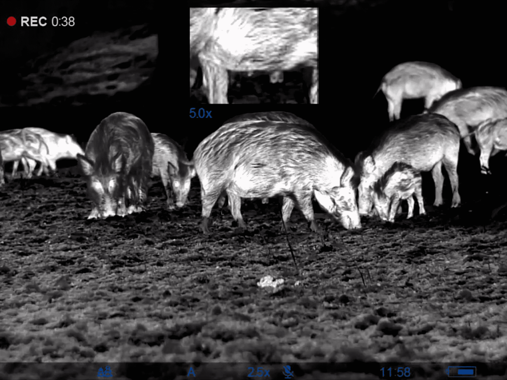
Thermal Shooting
What it is: Use of thermal optics and night‑vision systems to detect and engage animals in low‑light conditions.
Why it’s used: Enables safe, effective control at night when many feral species are most active and when thermal contrast is highest.
Thermal shooting is conducted under strict illumination and public‑safety plans for operations near populated areas.
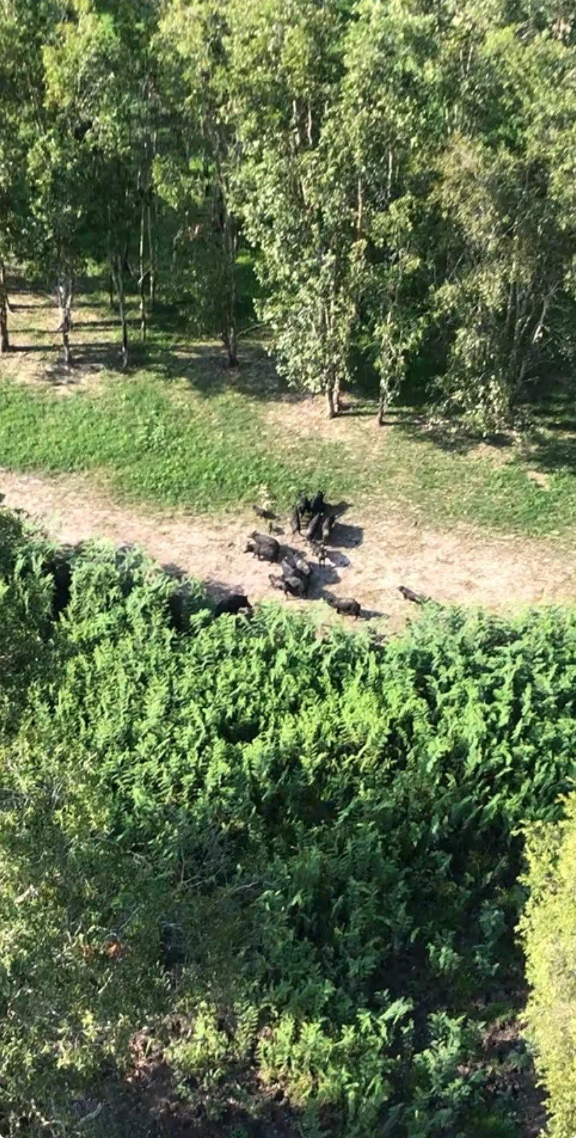
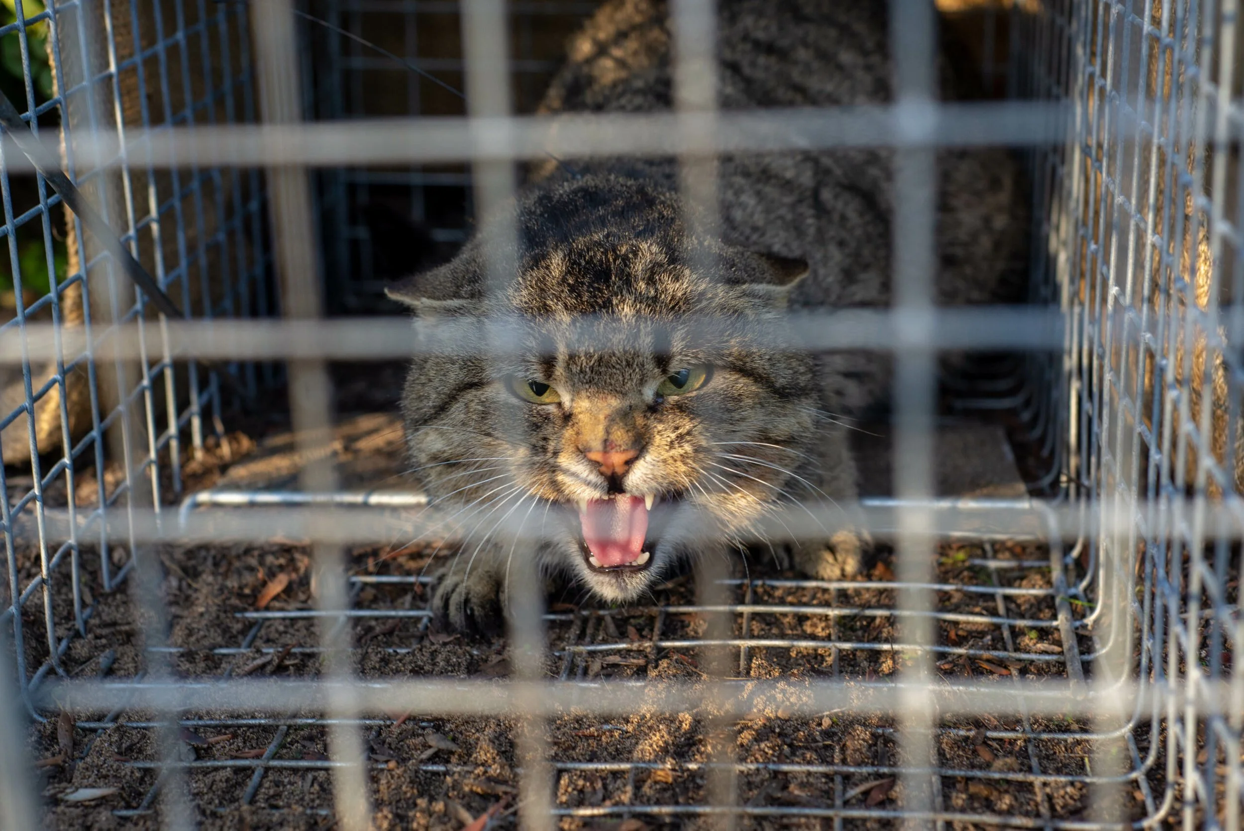
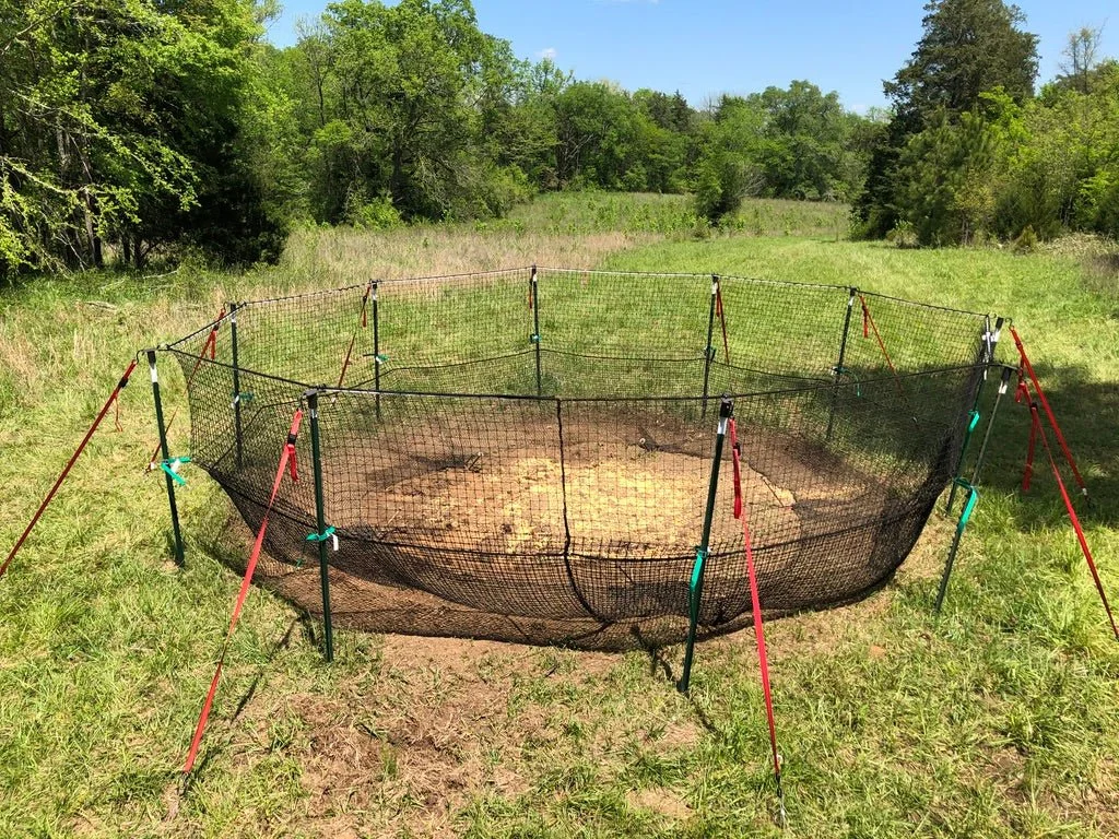
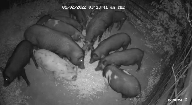
Trapping
What it is: Deployment of humane trapping systems (cage, soft‑catch and species‑specific traps) for targeted removal and live capture.
Why it’s used: For species where capture and relocation or surgical euthanasia is required; or where shot placement is impractical or unsafe.
Application: Urban areas that limit the safe use of firearms. Remote areas in which large numbers of animals are known to frequent, but the use of firearms is impractical or senstive. We use remote cameras to monitor and surveil trapping systems which prevents the need to visit trap sites daily.
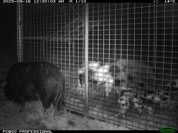
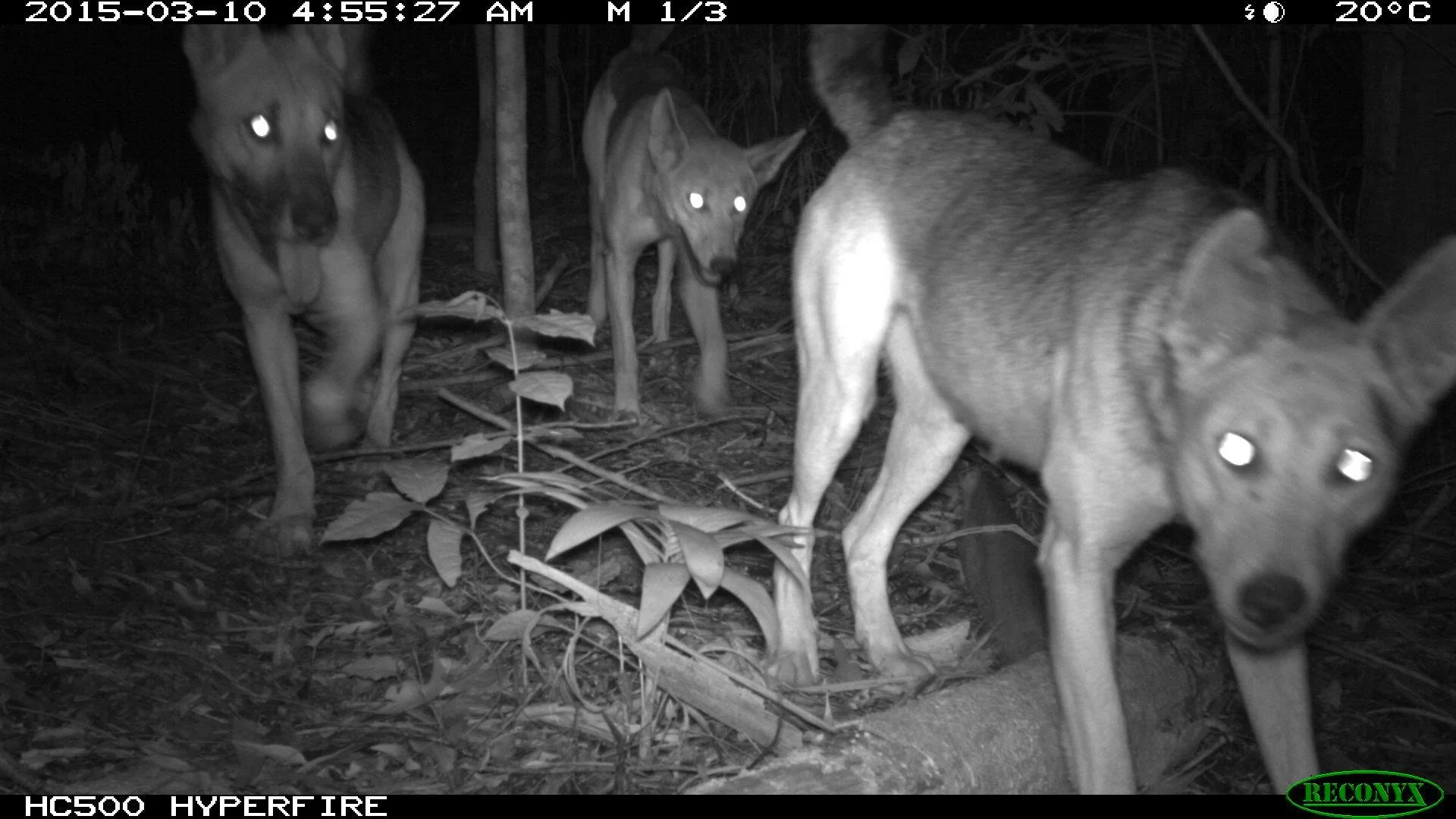
Thermal Drone & Camera Surveillance
What it is: Deployment of thermal drones and fixed camera systems for detection, mapping and real‑time surveillance.
Why it’s used: Rapid detection over large areas, monitoring, and intelligence for planning aerial or ground control operations.
Capability:
Civil aviation (CASA) compliant drone operation and BVLOS planning where required
Thermal sensor operation, interpretation and mapping outputs
Integration with GIS for population mapping and heat‑map outputs
Deliverables: Actionable maps, time‑stamped surveillance footage, and evidence packages for government reporting.
Injured or Dangerous Animal Control in Urban Settings
What it is: Rapid response to injured or hazardous animals in towns, suburbs, and around public infrastructure.
Why it’s needed: Public safety, animal welfare and minimising property damage near urban centres.
Capability:
Risk assessment for urban deployments and traffic management
Capture‑and‑contain techniques, sedation and humane euthanasia where authorised
Liaison with local authorities, police, animal welfare and public health teams
Approach: Discrete, documented and empathetic: protecting people first while meeting responsibilities to animal welfare and legal compliance.
Feral Animal and Overabundant Native Species Surveys, Mapping and Control
What it is: Scientific and field‑tested survey methods to quantify populations, assess impacts and design control programs.
Why it’s used: Good data drives effective management — targeted control, monitoring recovery and justifying funding/grants.
Training & capability:
Transect surveys, pellet counts, camera‑trap protocols and thermal transects
GIS mapping, population modelling and reporting
Adaptive control planning and long‑term monitoring frameworks
Outputs: Survey reports, GIS maps, recommended control schedules and post‑control monitoring plans.
Safety, compliance and ethics
Learn To Shoot operates to the highest standards of safety, legal compliance and animal welfare. Every engagement includes:
Written site‑specific risk assessments and SOPs
NT Police & CASA compliance where applicable
Cultural safety briefings and collaboration with Traditional Owners
Evidence and chain‑of‑custody reporting suitable for government and regulatory purposes
Who we work with
Land Councils & Indigenous ranger groups
Pastoralists and station managers
Mining and infrastructure operators
Local councils and airport authorities
Department of Defence
Northern Territory Government
Pest animal control contractors and environmental NGOs
Ready to engage?
For operational support, training packages or a site assessment, contact us by email or by phone.
Compliance note: All training and operational work is performed in accordance with relevant NT and Commonwealth legislation, and with respect for local cultural protocols. Please contact us to confirm the detailed scope, approvals and insurance requirements for your location.


Related Training & Courses
Expand your capability with nationally recognised and NT-approved firearms and safety training. Learn To Shoot delivers accredited courses designed for land managers, rangers, pastoralists, and corporate licence holders who need to operate safely and compliantly in the field.
👉 Firearms Safety Courses — Approved NT Firearms Safety Training for Categories ABCDH, including corporate and employee licensing.
👉 Thermal & Night Operations Training — Specialist instruction in thermal optics, night vision, and low-light field operations.
👉 Aerial Platform Shooting Training — Learn the skills and safety protocols for aerial animal control and range commissioning.
👉 Compliance & Risk Management for Animal Control — Focused training for Airport Safety Officers, EMOS staff, and Land Council personnel on lawful, humane pest control and firearms compliance.
Each course is delivered by experienced, NT Police-approved instructors with operational backgrounds in the use of firearms.